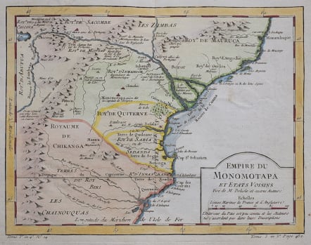
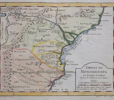
EMPIRE DU MONOPMOTAPA ET ETATS VOISINS
Sold
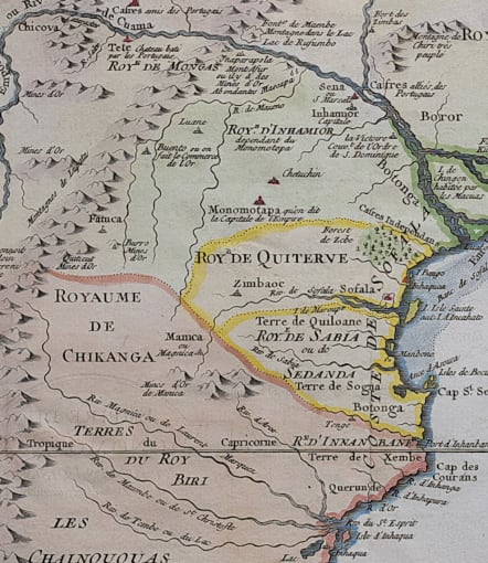
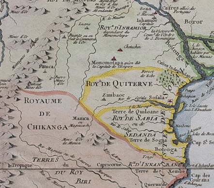
A detailed and interesting map of the Kingdom of Monomotapa roughly in today's Mozambique.
Covers the area ofthe coast of Mozambique, and the area of the Empire of Zimbabwe (c.1450-1629). Its capital was the 'Great Zimbabwe', marked here as 'Zimbaoc'. Based on Delisle, it includes the Zambeze River.
Good hand colour
Very good condition
code : M3567
Cartographer : Jacques-Nicolas BELLIN
Date : 1755c Paris
Size : 21*27 cms
availability : Sold
Price : Sold
Jacques-Nicolas Bellin (1703-1772) was one of the most important and prolific French cartographers of the mid-eighteenth century, in the service of the French Hydrographical Office. He was appointed the first Ingenieur Hydrographe de la Marine, and also Official Hydrographer to the French King.
Bellin was responsible for an enormous output of charts and maps. In a large folio format, he issued a volume of sea-charts of France, the Neptune Francois, and several sea-atlases of the World, including the Atlas Maritime and the Hydrographie Francaise. These large charts were amongst the best of the period and continued being reissued throughout the second half of the eighteenth century.
In smaller format, he issued the Petit Atlas Maritime (1764),which contained 580 detailed charts, as well as maps to illustrate l'Abbe Prevost's Histoire Generale des Voyages (1746-1757). Bellin also produced a substantial number of important separately issued maps, particularly reflecting continuing discoveries and political events in the Americas.


