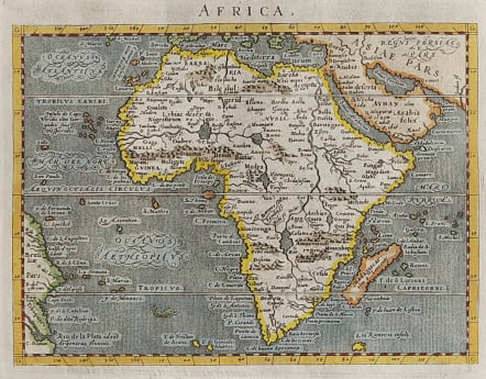
AFRICA
£265
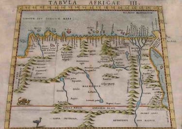
Attractive classic map of Africa and the Arabian Peninsula showing part of Brazil as well. Engraved by Girolamo Porro and primarily based on Ortelius. The rivers of central and north Africa feature prominently including the Ptolemaic concept of the origin of the Nile in two lakes south of the Equator. The largest of these lakes also has a river flowing southeast. The sea is stipple engraved with a tiny sea monster and decorative calligraphy.
Excellent hand colour
Set in a page of text
Excellent condition.
Geographer: Tolomeo
Author / geographer: Magini
Publisher: P. & F: Galignani
Engraver: G. Porro
code : M4568
Cartographer : MAGINI Giovanni
Date : 1572 Venice
Size : 13*17.5 cms sheet 30*20 cms
availability : Available
Price : £265
Giovanni Antonio Magini (1555-1617) was born in Padua, Italy, and studied medicine, mathematics, astronomy and philosophy at the University of Bologna where he was later to become a professor of astronomy. He corresponded with many of the renowned figures of the age including Ortelius, Tycho Brahe, Galileo and Johanes Kepler. He authored various works on astronomy and also produced the first printed atlas of Italy, which was published posthumously by his son Fabio. Other works included the "Geographiae Universiae" (1597) and "Moderne Tavole Di Geografia" amongst others.