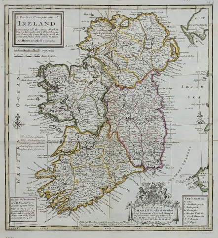
A POCKET COMPANION OF IRELAND
Sold
Beautifully engraved copper plate chart shows the island filled with towns and villages, roads, markets, bogs, Bishoprics, political divisions, and more. Simple title cartouche, but elaborate dedication cartouche "To His Grace Charles Duke of Grafton Lord Leutenant of Ireland…". Two compass roses align the map. The distance scales mark off Irish and English miles.
Folding as issued. Mint condition, strong impression and clean paper
This is a larger version of the earlier 1729 issue and it appears rarer.
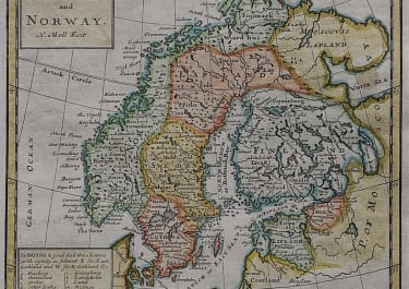
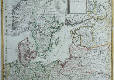
Published In: Atlas minor: or a new and curious set of sixty-two maps, in which are shewn all the empires, kingdoms, countries, states, in all the known parts of the earth; with their bounds, divisions, chief cities & towns, the whole composed & laid down agreable to modern history. By Herman Moll, Geographer. (3rd ed.) London, Printed for Thos. Bowles in St. Pauls Church Yard & John Bowles at the Black Horse in Cornhill (1736?)
http://www.davidrumsey.com/maps4639.html
code : M3265
Cartographer : MOLL Herman
Date : 1732 / 6 London
Size : 30.5*28 cms
availability : Sold
Price : Sold
Herman Moll (1654? - 1732) was an important 18th century map publisher and engraver based in London and Holland
He moved to London in 1680 where he worked as an engraver for Moses Pitt, among other London map publishers. Around the turn of the century, Moll set up his own shop where he produced a large corpus of work known for its high quality and decorative flair.