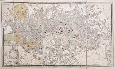
A NEW PLAN OF LONDON AND WESTMINSTER WITH THE BOROUGH OF SOUTHWARK 1826
Sold
Uncommon 1826 folding map of London disected and laid doan on canvas originally , with marbled boards.
Original colour , a little attractive age toning.
Covers area Hyde Park to Limehouse, and Chelsea to Bethnal Green.
Canvas back in v.good condition ..no splits etc and unlike photo no discolouration on front.
Overall a good condition folding map from1826
code : M3441
Cartographer : WYLD Family
Date : 1826
Size : 39*65 cms
availability : Sold
Price : Sold
James Wyld (senior) had been apprenticed to William Faden, taking over the business in 1823 and re-issuing many of Faden’s maps, and eventually became Geographer to His Majesty (George IV and William IV) and HRH the Duke of York. Wyld was also a founder member of the Royal Geographical Society in 1830 and had worked in the Quarter Master General’s Office. “Tooley’s Dictionary Of Mapmakers” tells us that Wyld’s career is also remarkable for having introduced lithography into map printing in “Plans Of The Peninsula Campaign” in 1812. The “Dictionary” also states that Wyld ‘died from overwork’ having had such an illustrious career.