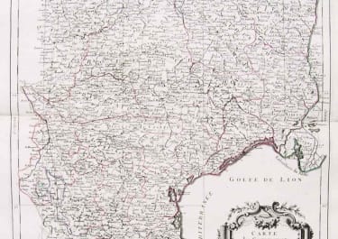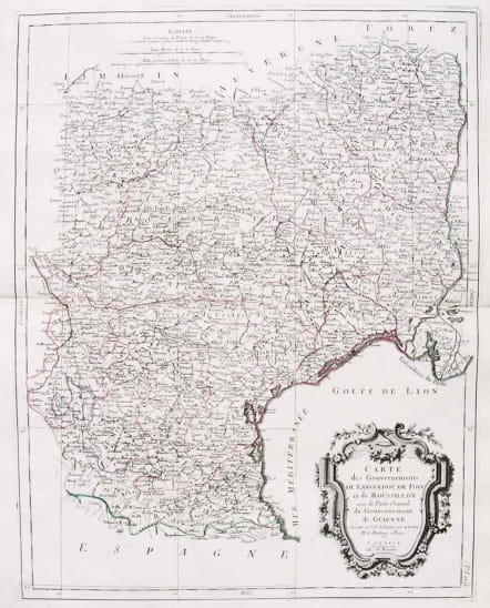
Carte des Gouvernements de Languedoc LANGUEDOC CARTE DES GOUVERNEMENTS DE LANGUEDOC , DE DFOIX ET DE ROUSSILLON
£125
Large Folio.
Attractive map of part of France, covering the western part of the Gulf of Lyon with its hinterland. Decorated with a rococo title cartouche.
Venetian edition of the map by Bonne, to whom Santini gives credit in the cartouche.
From "Atlas Universel" published by Santini in 1776-84. The atlas is effectively an Italian copy of the Robert de Vaugondy 'Atlas Universel'.
In 1784 Santini sold the plates to M. Remondini, whose name appears on this particular example.
Original outline colour.Mint condition, printed on heavy paper.
code : M2620
Cartographer : SANTINI Francois
Date : 1778 Venice
Size : 59*46 cms
availability : Available
Price : £125
Francois [Francesco] Santini was a Venetian map maker who re-issued the works of Robert de Vaugondy, Homann’s Heirs and De L’Isle. At this time, cartography in Italy was at a rather low ebb, so Santini, essentially a publisher rather than a map-maker modelled his work on two of the leading practitioners of cartography in Europe, the French map-makers Gilles and Didier Robert de Vaugondy. Their “Atlas Universel” was first published in 1758, and was much re-issued thereafter. The atlas was a commercial and cartographic success, with widespread influence on map-makers throughout Europe, most notably on Santini, who commissioned a new set of plates, published in 1776, being almost exact copies of the original French maps.