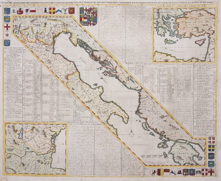
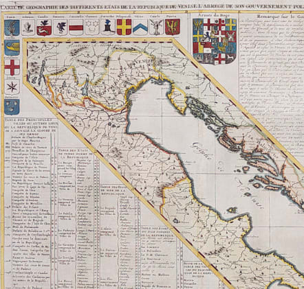
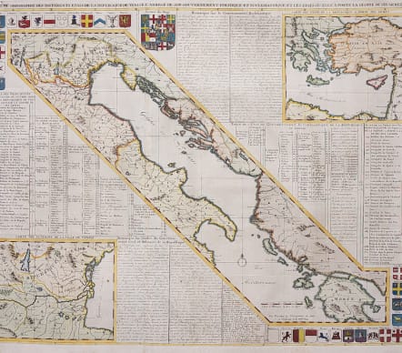
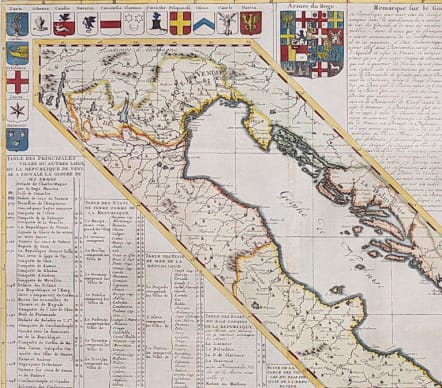
CARTE DE GEOGRAPHIE DES DIFFERENTS ETATS DE LA REPUBLIQUE DE VENISE..
£335
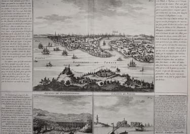
Attractive large map focusing on the geography, politics and military achievements of the Republic of Venice. The central map shows the Adriatic Sea flanked by Italy and the Balkans, with the Republic of Venice at top. At bottom left is an enlarged map of the region surrounding the Republic of Venice, and a counter-balancing map at top right shows the eastern Mediterranean and illustrates countries where the Republic of Venice has gone to battle. The three maps are surrounded by numerous coats of arms, an index of locations of cities on the maps, and French text describing the government and military pursuits of the Republic of Venice.
Excellent hand colour
Near Mint
code : M4221
Cartographer : CHATELAIN Family
Date : 1719 Amsterdam
Size : 50*61.5 cms
availability : Available
Price : £335
Zacharie Chatelain (d.1723) was the father of Henri Abraham (1684-1743) and Zacharie Junior (1690-1754). They worked as a partnership publishing the Atlas Historique, Ou Nouvelle Introduction A L’Histoire … under several different Chatelain imprints, depending on the Chatelain family partnerships at the time of publication. The atlas was published in seven volumes between 1705 and 1720, with a second edition appearing in 1732. The maps were accompanied by information pertaining to cosmography, geography, history, chronology, genealogy, topography, heraldry, and costume of the world.