IAE ROMANA
Sold
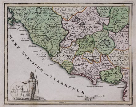
Rare map of the region around Rome in Roman times.
Detailed in so much as showing all the main Roman roads.
Provinces marked by colour.
Cartouche
Excelent original colour
Very good condition
code : M4315
Cartographer : WEIGEL Christoph
Date : 1740c
Size : 16*20 cms
availability : Sold
Price : Sold
Christoph Weigel (c.1654-1725) and his relation Johann Weigel worked out of Nuremberg in the first half of the eighteenth century. Weigel is also known for a number of maps featuring in Faber’s “Atlas Scholasticus” (1718) and also the “Schul- Und Reisen Atlas”, produced in conjunction with JD Köhler.
Weigel was also involved with Köhler’s “Descriptio Orbis Antiqui” published c.1720. This volume contained in total forty four well engraved maps of the ancient world, many decorated with vignettes illustrating coins, medallions and mythological scenes.