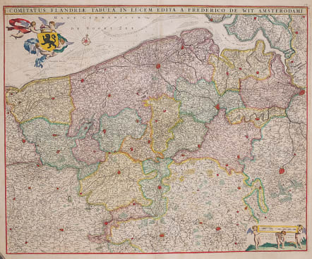
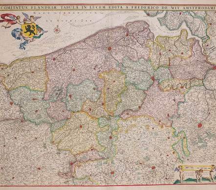
COMITATUS FLANDRIAE TABULA
Sold
A very attractive map of Flanders, the whole Belgian region northwest of Brussels, confined by Antwerp, Brussels, Valenciennes, Arras, St. Omer and the Channel.
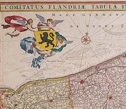
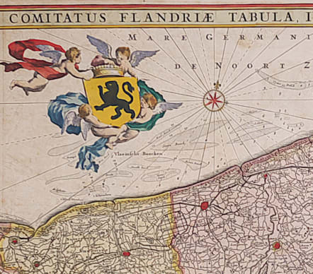
Title heading above the map, coat of arms supported by cherubs, and scale of miles.
Towns highlightened in red.
Excellent example of this map in great full original colour.
code : M3506
Cartographer : DE WIT Frederick
Date : 1680 Amsterdam
Size : 46*56 cms
availability : Sold
Price : Sold

Europe Continent

Germany & Austria


Low Countries