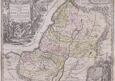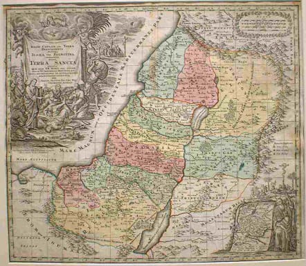
(HOLY LAND) TERRA SANCTA
Sold
A strong and early impression in old contemporary hand-colour in wash and outline. Large decorative allegoric title cartouche and in the lower right corner a small inset map ornated with allegoric, figurative scenes. Detailed map, showing and naming many historical places in the Holy Land and depicting the 12 tribes.The cartouches are illustrated with allegories to the old testament. Some damp staining mainly in margins but affecting printed surface on left,otherwise a stunning map in good condition.
code : M517
Cartographer : SEUTTER Family
Date : 1720 Augsberg
Size : 49.5*58cms
availability : Sold
Price : Sold
Besides the Homanns, the other great German publishers of the eighteenth century were the Seutter family. Mattheus Seutter the elder (1678-1757) was apprenticed to Johann Baptist Homann in 1697 in Nuremberg, but left to settle in Augsburg where he established his own business publishing atlases, including the "Atlas Geographicus" (1725) and "Grosser Atlas" (circa 1735). Seutter's style was heavily influenced by Homann, with distinctive similarities appearing in his maps. He was joined in the business by his son, Albrecht (1722-1762), who continued the firm in partnership with Tobias Conrad Lotter (1717-1777) on his father's death.