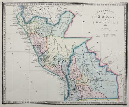
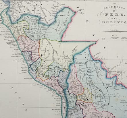
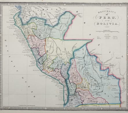
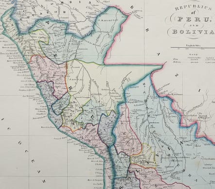
REPUBLICS OF PERU AND BOLIVIA
£75
Exceptionally attractive original hand colour map of Peru & Bolivia.
Iquitos and the Amazon in the North and a general Bolivia in the South which appears to extend to the Pacific Ocean.
All provinces marked.
Country size and populations.
Exceptionally fine engraving and hand colour
Mint condition for this uncommon map.
code : M4438
Cartographer : WYLD Family
Date : 1840 London
Size : 23*28 cms
availability : Available
Price : £75
James Wyld (senior) had been apprenticed to William Faden, taking over the business in 1823 and re-issuing many of Faden’s maps, and eventually became Geographer to His Majesty (George IV and William IV) and HRH the Duke of York. Wyld was also a founder member of the Royal Geographical Society in 1830 and had worked in the Quarter Master General’s Office. “Tooley’s Dictionary Of Mapmakers” tells us that Wyld’s career is also remarkable for having introduced lithography into map printing in “Plans Of The Peninsula Campaign” in 1812. The “Dictionary” also states that Wyld ‘died from overwork’ having had such an illustrious career.