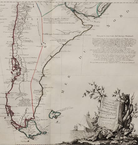
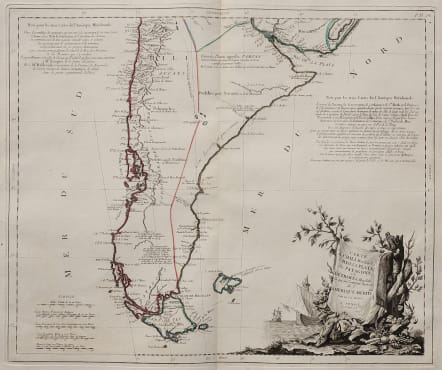
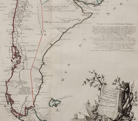
CHARTE DU CHILI MERIDIONAL, DU RIO DE PLATA DES PATAGONS
£285
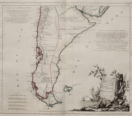
Superb large folio map of Patagonia by Santini.
A very interesting map of all Patagonia, Tierra del Fuego, Chile and Argentina to the Plate estuary. Based on the French mapmaker Johann Baptist D'Anville's map of the continent, the map has a number of detailed panels of annotations concerning the history of the region.
Many tribes and Indigenous peoples marked. A large decorative title piece is set on a banner hanging off a large tree stump.
Some original outline colour.
Mint condition
code : M4646
Cartographer : SANTINI Francois
Date : 1779 VENICE
Size : 45*55 cms
availability : Available
Price : £285
Francois [Francesco] Santini was a Venetian map maker who re-issued the works of Robert de Vaugondy, Homann’s Heirs and De L’Isle. At this time, cartography in Italy was at a rather low ebb, so Santini, essentially a publisher rather than a map-maker modelled his work on two of the leading practitioners of cartography in Europe, the French map-makers Gilles and Didier Robert de Vaugondy. Their “Atlas Universel” was first published in 1758, and was much re-issued thereafter. The atlas was a commercial and cartographic success, with widespread influence on map-makers throughout Europe, most notably on Santini, who commissioned a new set of plates, published in 1776, being almost exact copies of the original French maps.