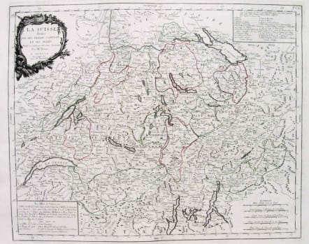
SZWITZERLAND LA SUISSE DIVISEE EN SES TREIZE CANTONS
£145
Large Folio.
Attractive and detailed map of Switzerland from Geneva to Lake Constance.
From the Venetian edition of Giles Didier Robert De Vaugondy's map from Atlas Universel printed in 1776-84.Cartouche.Original outline colour.Mint condition.
code : M2619
Cartographer : SANTINI Francois
Date : 1778 Venice
Size : 45*56 cms
availability : Available
Price : £145
Francois [Francesco] Santini was a Venetian map maker who re-issued the works of Robert de Vaugondy, Homann’s Heirs and De L’Isle. At this time, cartography in Italy was at a rather low ebb, so Santini, essentially a publisher rather than a map-maker modelled his work on two of the leading practitioners of cartography in Europe, the French map-makers Gilles and Didier Robert de Vaugondy. Their “Atlas Universel” was first published in 1758, and was much re-issued thereafter. The atlas was a commercial and cartographic success, with widespread influence on map-makers throughout Europe, most notably on Santini, who commissioned a new set of plates, published in 1776, being almost exact copies of the original French maps.