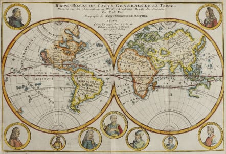
MAPPE-MONDE OU CARTE GENERALE DE LA TERRE
£395
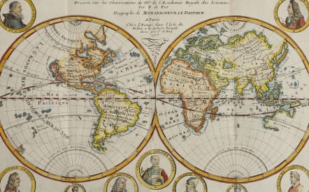
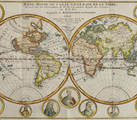
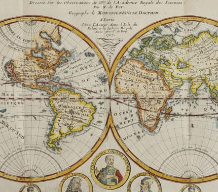
Attractive and sought after double hemispher map that features California as an island. Surrounding the hemispheres are nine medallion portraits of explorers, including La Salle, Tachard, Dampier, Magellan, Drake, Columbus, Vespucci, Marco Polo, and Schouten. The map shows early mapping of North America with the Great Lakes not completely formed. The northeast coast of Asia includes a coastline labeled Roye. de Coree stretching off the map in the direction of North America. Australia and New Zealand are tentatively drawn and named Nouvelle Hollande and Nouv. Zeeland. According to Shirley, this map may have been copied directly from the similar map by Mortier (see Shirley 572), however since the dating on the Mortier map is uncertain, it is possible that Mortier copied de Fer. This is the third edition, dated 1717.
Excellent hand colour
Very good condition
References: Shirley #601; Pastoureau, FER 1D.
code : M4840
Cartographer : DE FER Nicolas
Date : 1717 Paris
Size : 23*34.5 cms
availability : Available
Price : £395
Nicolas de Fer (1646-1720) was the son of Antoine de Fer, also a map engraver and colourist in his own right who had worked with Nicolas Berey and acted as an editor for Pierre Duval's "Cartes De Geographie ..." of 1657. However, it was Nicolas who was to become one of the most prolific publishers of his time.
De Fer was able to make the publishing business flourish and in 1690 he was nominated as geographer to the Dauphin - their relationship had reciprocal benefits with De Fer producing, in effect, royal propaganda concerning the Dauphin's lands with each publication enhancing his own name and reputation, as well as that of the Dauphin. When the Duke of Anjou ascended the throne in 1702, De Fer had the dual title of "geographe du roi d'Espagne et du Dauphin".
De Fer published a number of atlases including the "Cotes de France" of 1690 (containing Tassin's maps) and the "Forces de l'Europe ou Introduction a la fortification", also of 1690, that reinforced his abilities and success with the buying public. Subsequent publications included the "Petit et Nouveau Atlas", which appeared in 1697, followed by the "Atlas Curieux". The "Atlas Curieux" was well-known and popular, being expanded in successive editions between 1700 and 1705, and was re-edited in 1714 and 1716 under the title "Suite de l'Atlas Curieux". De Fer also produced a number of folio maps that appeared in the "Atlas ou Recueil de cartes", which was published in 1709.