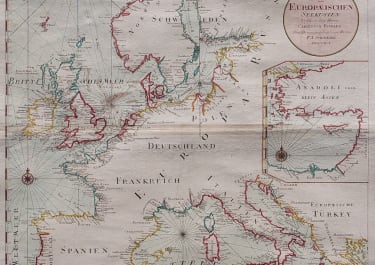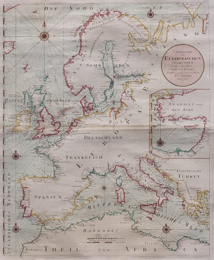
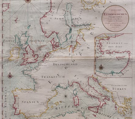
UBERSICHT EUROPAEISCHEN SEE SEE KUSTEN MDCCXCL
£450
Rare highly decorative sea chart of Europe.
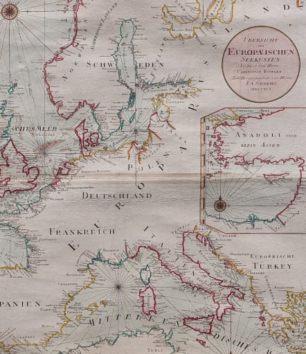
This large sea chart of the waters surrounding Europe is the uncommon Austrian version of Carrington Bowles map. Considerable coastal detail with completely blank interior. Large inset of "Anadoli oder Klein Asien" focusing on the island of Cyprus. The handsome chart is arrayed with rhumb lines radiating from six compass roses. Wide margins and sturdy paper.
Original and added outline colour.
Excellent condition
code : M5595
Cartographer : Franz Schraembl
Date : 1791 Vienna
Size : 60*49 cms sheet 66*57 cms
availability : Available
Price : £450
SCHRAEMBL, Franz Anton
1751-1803
In the last decades of the eighteenth centurv Anton Schrambl and Joseph von Reilly led a successful revival of map making in Vienna.
Completion of Schrambl's ambitious World Atlas, started in 1786, based on the best available sources of the time, was much delayed and the maps were issued piecemeal year by year until the whole atlas appeared in 1800. 1786-1800 Algemeiner Grosser At/as