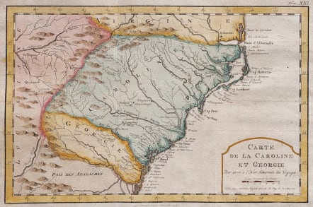
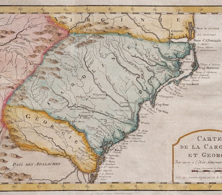
CARTE DE LA CAROLINE ET GEORGIE
£225
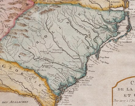
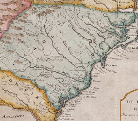
Attractive & detailed map of the colonies of Carolina and Georgia from just north of Albemarle to Jekil Isle, extending inland to the Appalachians and showing part of Eastern Tennessee.
Shows extensive river system, mountains, islands and some early settlements on both sides of the mountains.
Excellent hand colour
Mint condition
code : M5587
Cartographer : Jacques-Nicolas BELLIN
Date : 1754 Paris
Size : 19*28.5 cms sheet size 25*38 cms
availability : Available
Price : £225
Jacques-Nicolas Bellin (1703-1772) was one of the most important and prolific French cartographers of the mid-eighteenth century, in the service of the French Hydrographical Office. He was appointed the first Ingenieur Hydrographe de la Marine, and also Official Hydrographer to the French King.
Bellin was responsible for an enormous output of charts and maps. In a large folio format, he issued a volume of sea-charts of France, the Neptune Francois, and several sea-atlases of the World, including the Atlas Maritime and the Hydrographie Francaise. These large charts were amongst the best of the period and continued being reissued throughout the second half of the eighteenth century.
In smaller format, he issued the Petit Atlas Maritime (1764),which contained 580 detailed charts, as well as maps to illustrate l'Abbe Prevost's Histoire Generale des Voyages (1746-1757). Bellin also produced a substantial number of important separately issued maps, particularly reflecting continuing discoveries and political events in the Americas.


