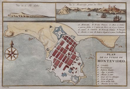
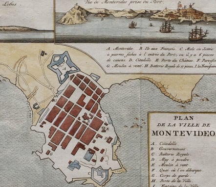
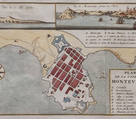
PLAN DE LA VILLE DE MONTEVIDEO
£145
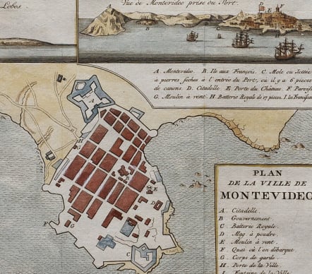
Interesting uncommon planof Montevideo . View of town top right and top left view of Island of Lobos.
It was a relatively small town. The 1724 census counted more than 100 families of Galician and Canary Islands origin, more than 1000 indigenous people, mostly Guaraní, as well as some trafficked slaves of Bantu origin. Probably not much larger by 1750.
Decorative compass rose.
Excellent hand colour
Mint condition
code : M5586
Cartographer : Jacques-Nicolas BELLIN
Date : 1754 Paris
Size : 16.5*24 cms sheet size 25*36 cms
availability : Available
Price : £145
Jacques-Nicolas Bellin (1703-1772) was one of the most important and prolific French cartographers of the mid-eighteenth century, in the service of the French Hydrographical Office. He was appointed the first Ingenieur Hydrographe de la Marine, and also Official Hydrographer to the French King.
Bellin was responsible for an enormous output of charts and maps. In a large folio format, he issued a volume of sea-charts of France, the Neptune Francois, and several sea-atlases of the World, including the Atlas Maritime and the Hydrographie Francaise. These large charts were amongst the best of the period and continued being reissued throughout the second half of the eighteenth century.
In smaller format, he issued the Petit Atlas Maritime (1764),which contained 580 detailed charts, as well as maps to illustrate l'Abbe Prevost's Histoire Generale des Voyages (1746-1757). Bellin also produced a substantial number of important separately issued maps, particularly reflecting continuing discoveries and political events in the Americas.