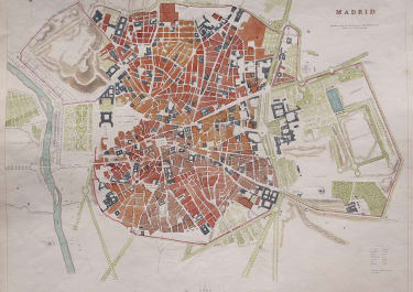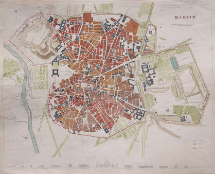
MADRID
£195
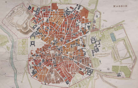
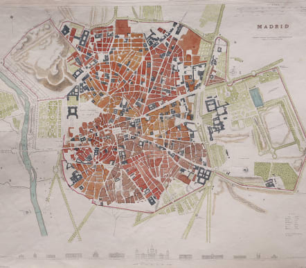
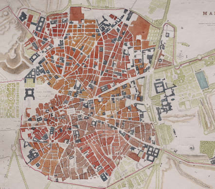
This attractive & detailed of Madrid was published in 1831 by the Society for the Diffusion of Useful Knowledge, also referred to as SDUK.
Founded on a steep bank of the Manzanares River as a fort in the 9th century CE, the city became important in the 10th century as a military stronghold. In the 16th century it became the capital of Spain under Phillip III. In the upper left hand corner the map depicts the escarpment on which the city was built. The city proper is highly detailed, with city walls colored red. Gardens and plazas are denoted, and directly under the city plan are miniature depictions of major architectural edifices in the city, along with their names.
Extra professional hand colouring on the plan makes this map sought after.
Excellent condition
code : M5591
Cartographer : CLARKE W.B.
Date : 1831 London
Size : 30*38 cms sheet size 33*40.5 cms
availability : Available
Price : £195
English Engraver Working for SDUK