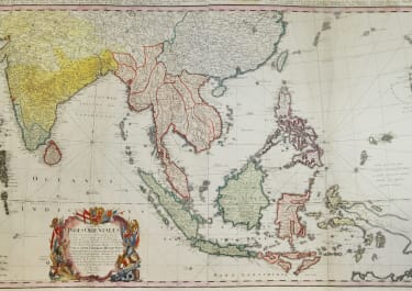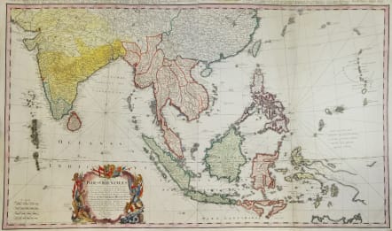
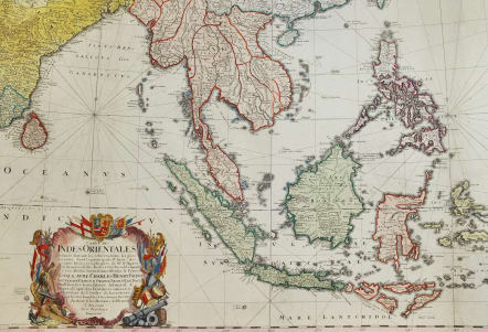
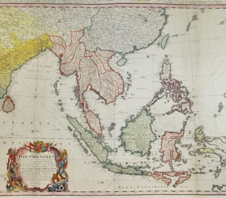
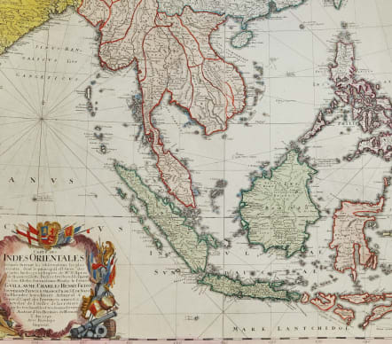
CARTE DES INDES ORIENTALES
£785
Stunning scarce in complete form of 2 sheets joined .
Large original hand coloured copper plate engraved antique map map of India, SE Asia, The East Indies, Philippines, New Guinea & Australia was engraved by Sebastian Dorn in 1748, dated, * with Imperial Privilige and published by the Homann firm.
The map is based upon the sea charts created by Jean-Batiste de Mannevillette (1707-80), for the first edition of his Le Neptune Oriental, the first sea atlas of Asian Waters. Mannevillette apprenticed under the great royal cartographer Guillaume De L\'Isle. He then joined the maritime service of the Compagnie des Indes, eventually attaining the rank of captain. Upon his return to Paris, Mannevillette was appointed as director of the Dépôt des Cartes et Plans de la Navigation des Indes.
In 1745, Manneveillette published the first edition of his sea atlas of Asian waters, Le Neptune Oriental. The high quality of Mannevillette\'s charts won him the acclaim of both mariners and academics alike, and he was admitted as a fellow of the Academy of Sciences.
Very detailed
Highly decorative with Cartouche Rhum lines etc
Printed on heavy paper
Very good condition
Full title
Carte des Indes orientales dessine´e suivant les observations les plus recentes, dont le principal est tire´e des cartes hydrographiques de Mr. D'Apres de Mannevillette. Dediée tres humblement à Son Altesse Serenissime Monsgr. le Prince Guillaume Charles Henry Friso, Souverain Prince d'Orange, Pr. de S.E. de Nassa, Stadthoudre hereditaire, Admiral et General Capit. des Provinces unies etc. etc, Chevalier de l'Ordre de Jarretiere, par ses tres humbles et tres soumis serviteurs l'Auteur et les. Heritiers de Homan. I. Feuille dans la quelle on represente les Indes deca la Riviere de Ganges, le Golfe de Bengale, Siam, Malacca, Sumatra. II. Feuille, qui comprend les isles de Sonde, l'archipel des Philippines, & les isles Moluques. dressee´ par Mr. Tobie Mayer de la Societe´ Geograph.
code : M5684
Cartographer : Homann
Date : 1748
Size : 52*87 cms
availability : Available
Price : £785
The Family HOMANN
Johann Baptist Homann (1664-1724) started his career in Amsterdam as an apprentice with the Danckerts family before returning to Nuremberg to establish himself in business in 1702. The firm quickly became the principal geographical publishers in Germany and in 1715 Homann was appointed Geographer to the Holy Roman Emperor and he was also a member of the Prussian Royal Academy of Sciences. His publications included the “Neuer Atlas Ueber Die Gantze Welt ...” in 1707-. The “Grosser Atlas ...” of 1716- and the “Atlas Novus Terrarum Orbis Imperioa” in c.1720, as well as many others. Johann died in 1724 and was succeeded by his son Johann Christoph who died in 1730. After his death the firm took the name Homann’s Heirs and continued thereafter until 1813. Publications with the Homann’s Heirs’ imprint included the “Grosser Atlas” in 1731, Doppelmays’r “Atlas Coelestis ...” in 1742 and the “Atlas Geographicus Maior ...” in 1753-, amongst others. Throughout this entire period the firm were the leading map publishers in Germany, employing a number of very important cartographers