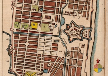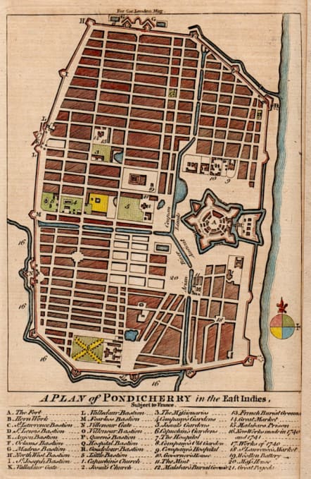
A PLAN OF PONDICHERRY IN THE EAST INDIES SUBJECT TO FRANCE
£60
This small yet striking plan shows the city of Pondicherry in southeastern India when it was under French control.
Beneath the plan, an extensive keys identifies sites of interest, including fortifications, churches, gardens, hospitals, the governor's house, and the Great Pagoda.
Good hand colour
Right margin extended no loss to map
Good condition
Ref: Jolly #LOND-167.
code : M5653
Cartographer : KITCHIN Thomas
Date : 1759 London
Size : 18*12 cms sheet size 20.5*13.5 cms
availability : Available
Price : £60
Thomas Kitchin (1718-1784) was one of the best and most prolific engravers of the eighteenth century. He issued The General Atlas, Describing the Whole Universe , first published in 1773, and regularly reissued thereafter. His work also included a large number of maps of the English counties, particularly for the London Magazine (1747-1760), the Universal Magazine (1747-1766), and for Dodsley’s England Illustrated (1764). Other maps were published in conjunction with Emanuel Bowen in the Large English Atlas and the Royal English Atlas (1763).