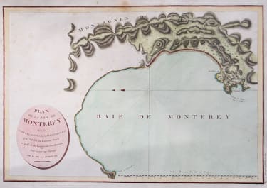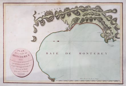
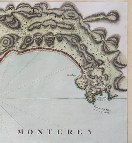
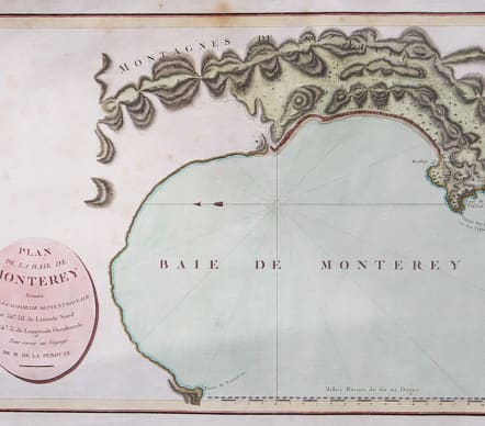
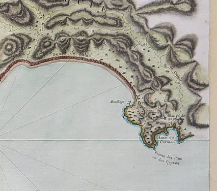
PLAN DE LA BAIE DE MONTEREY
£275
Full title Plan de la Baie de Monterey Située dans la Californie Septentrionale.
First edition of La Perouse's plan of Monterey Bay, the earliest obtainable map of the region.
During his round the world voyage, La Perouse coasted southward along the California coast in 1786, passing San Francisco on September 10, and arriving in Monterrey on September 13, where he remained for 9 days, before setting out for the Philippines.
La Perouse's map of Monterey is the only one of his California maps from original sources. His other maps of California harbors derive from Spanish sources, obtained during the voyage. As a result, the detail in the region is excellent, especially in the interior.
An essential map for Monterey and 18th Century California collectors.
Excellent hand hand colour
Very good condition
code : M5603
Cartographer : De La Perouse
Date : 1797 Paris
Size : 34*49 cms sheet size 43*56 cms
availability : Available
Price : £275
Jean-François de Galaup, comte de La Pérouse (1741–1788), are highly regarded 18th-century French maritime charts published in the 1797 Atlas du Voyage de la Pérouse. These maps, often engraved by P.F. Tardieu for the Imprimerie de la République in Paris, document his Pacific expedition, including key, early detailed surveys of the Californian/Oregon coast and Japan.
Known for meticulous coastal detail, including the route of his expedition, the Astrolabe and Boussole.