HEMISPHERE AUSTRAL OU MERIDIONAL ET ANTARTIQUE
£485
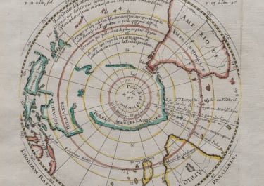
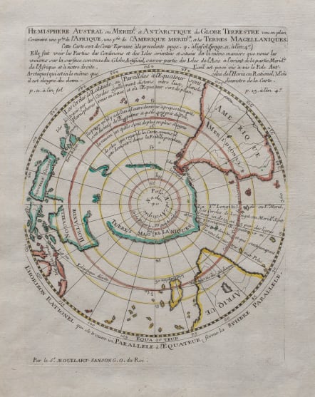
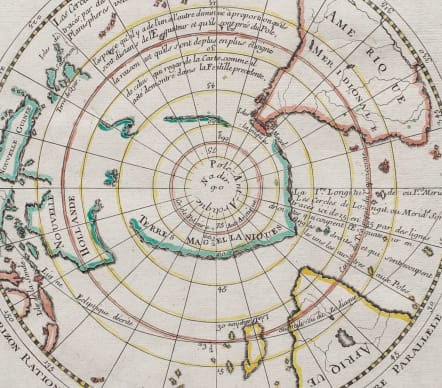
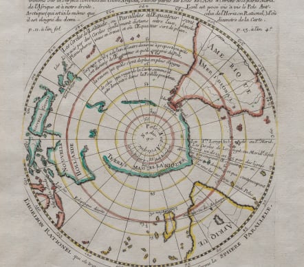
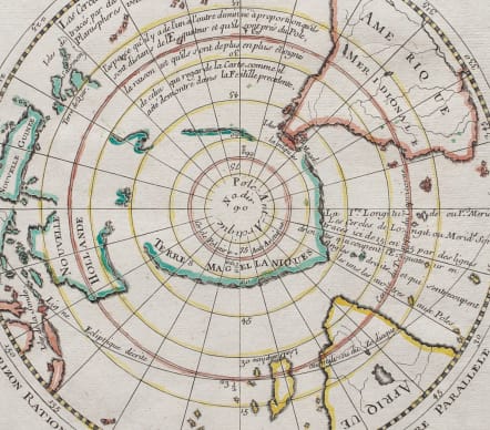
The Hémisphère Austral ou Méridional et Antarctique du Globe Terrestre... is a rare and highly collectible 18th-century antique map created by the French Royal Geographer Pierre Moullart-Sanson. First published in Paris around 1704 to 1725, this beautiful copperplate engraving captures the European understanding of the Southern Hemisphere long before the epic voyages of Captain James Cook.
Scarce projection of the Southern Hemisphere, including a completely mythical Terres Magellaniques (Antarctica), very incomplete Australia, retaining a connection, if tentatively, to New Guinea, as well as portions of the Solomon Islands and parts of Oceana and SE Asia. The southern portions of Africa and South America are also shown. An exceptionally scarce and interesting work.
Pre-Cook Australia (“New Holland”): Because it predates mid-18th-century explorations, the map depicts Australia only in partial outline. The eastern coast is entirely missing or speculative, reflecting the limits of early Dutch discoveries.
The Mythical South Land: It includes early representations of the Terres Antarctiques (Antarctic lands), which at the time were largely theoretical coastlines blended with a few genuine sightings of sub-Antarctic islands.
Scope & Geography: The circular polar projection spans the entire southern portion of the globe, capturing the southern tips of South America and Africa, floating alongside the vast, uncharted southern oceans.
*Individual sheets of this map feature original hand-outlined coloring. Due to Moullart-Sanson's unique experimental styles—often publishing maps meant to be viewed as if looking at the inside of a hollow globe—this particular rendering is vastly scarcer than the standard standard southern hemisphere maps published by his contemporaries like Guillaume Delisle or later cartographers.
Single folio sheet
Mint condition
Tooley #1116.
code : M5662
Cartographer : SANSON Nicolas
Date : 1704 Paris
Size : 26*20 cms sheet size 41*26 cms
availability : Available
Price : £485
Nicolas Sanson (1600-1667) is generally acknowledged as the founder of the great French school of geographers and cartographers that supplanted the Dutch as the leading European map-makers. His work was acclaimed for its geographical accuracy and high standard of engraving. As a consequence, his many maps received a wide diffusion. His career marks the start of the process by which Paris superseded Amsterdam as the centre of European map production.
Nicolas studied Ancient History as a young man, and this awoke in him an interest in classical geography. His first map, of ancient Gaul was made in 1618, when he was only 18. Sanson had three sons, Nicolas (1626-1648), Guillaume (d.1703) and Adrien (d.1708), and a grandson Pierre Moullard-Sanson (d.1730), all of whom were involved in the family’s map-making activities.
After Sanson settled in Paris his work came to the attention of King Louis XIII, who eventually appointed Sanson Geographe Ordinaire du Roi, one of whose duties was to tutor the King in geography. Sanson published some 300 maps in his career, though his first most famous atlas, the folio “Cartes Generales De Toutes Les Parties Du Monde” was not published until 1658. Sanson also prepared a series of quarto atlases of the different continents. These scarce atlases are more frequently encountered in the Dutch piracy, engraved by Anthony d’Winter, first published in 1683.
The Sanson atlases are rarely found with a standard set of maps; the practice seems to have been that additional, or revised, plates would be inserted as available. After Sanson’s death the business was continued by his two surviving sons and grandson, in partnership with, and later superseded by Alexis Hubert Jaillot.