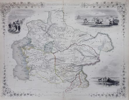
INDEPENDENT TARTARY
£95
Showing parts of Kazakhstan, Uzbekistan & Turkestan, markin Bukhara, Samarkand and Tashkent, with engraved vignette scenes of Tartar nomadic life. The 'Great Game' was the name for the Anglo-Russian rivalry in Central Asia, with Russia pushing south to threaten British India through Afghanistan. At the time this map was published the Crimean War and the India Mutiny had made the Game more intense. Less than a decade later Independent Tartary had gone: Tashkent was annexed by Russia in 1865, and Samarkand & Bukhara came under Russian control in 1868
Very good condition.
code : M2888
Cartographer : Tallis John
Date : 1861 London
Size : 26*33 cms
availability : Available
Price : £95
TALLIS, John
active 1838-1851
John Tallis founder of Tallis and Co., London map publishers who traded under various names: L. Tallis, Tallis & co, John Tallis, John Tallis & co. (London & New York) between 1838 and 1851. After 1850-51, their maps were published by the London Printing and Publishing Co., London and New York.
The Illustrated Atlas of the World, published in 1849 with the maps and decorative vignette's engraved and drawn by J. Rapkin, was one of the last atlases to be truly decorated and is therefore highly prized.


