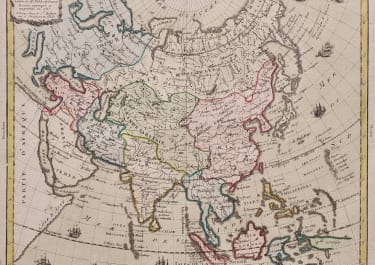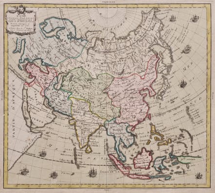
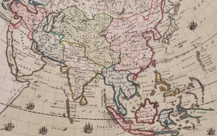
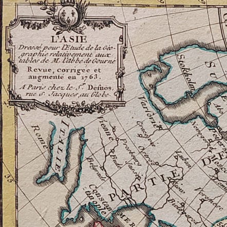
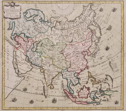
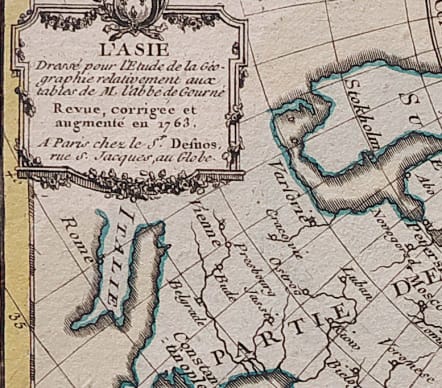
L'ASIE DRESSE POUR DE L'ETUDE DE LA GEOGRAPHIE
£275
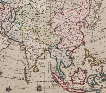
Highly decorative map of Asia embellished with a landscape style title cartouche and several sailing ships.
Full original colour.
The map is of interest for the use of Mer de Corée, the sea between Korea and Japan.
Prepared by Louis Brion de la Tour and published by Louis Charles Desnos, active in Paris at rue St.Jacques.
Good early impression
code : M5478
Cartographer : DESNOS Louis
Date : 1763 Paris
Size : 24*27 cms sheet size 26.5*36.5 cms
availability : Available
Price : £275
Louis Charles Desnos (1728-1805) was a renowned mapmaker, globemaker and publisher of Paris. Throughout his considerable career Desnos worked with most of the eminent cartographers of his day. He came to control plates by Buy de Mornas, Brion de la Tour and Robert de Vaugondy amongst others and re-issued works by de Fer and Le Rouge. All this at a time when Paris could still be regarded as one of the largest centres of European map production.
Desnos first continued to work at the Hardy place in the rue Saint-Julien-le-Pauvre in Paris, but in 1757, when he became a freeman, he moved to a new place, at the sign of the Globe in rue Saint-Jacques.
From 1759 he called himself 'ingénieur-géographe et libraire du roi de Danemark'. In the 1760's Desnos extended his activities as a publisher of maps and books. Globe making became less important for him, perhaps because of the success of his main competitor Didier Robert de Vaugondy.
Desnos’ works included a wide variety of cartographic subjects. Notable works include the “Petit Atlas Elementaire …” (c.1865) and the “Atlas National Et Génèral De La France” (1790) as well as many more.