SUMATRA
£675
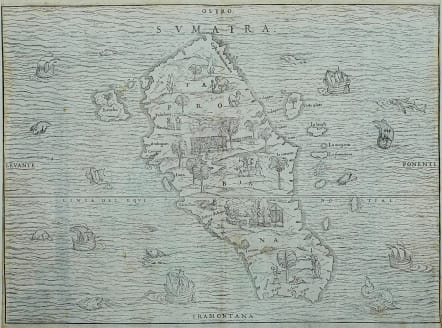
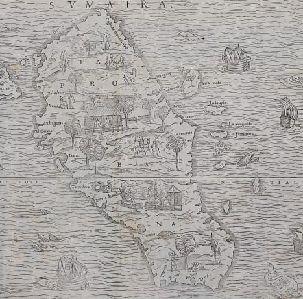
A superb example of "the first separate map of any Southeast Asian island to be based on actual observation" (Suarez). It was based on the reports of the two Parmentier brothers, who while in residence on the island made an abortive attempt to break the Portuguese monopoly on trade in the region. The very attractive woodcut shows trees, dwellings, animals and people, and the surrounding sea is filled with ships and sea monsters. This first woodblock was destroyed in a fire soon after publication and is consequently scarce on the market. Margin tight on sides and professionally extended with 16th century paper for fraling. All printed surface of map complete. No repairs to map.
Uncoloured as issued.
Very good condition
Ramusio’s Navigationi et Viaggi.
One of the larger printing projects of the sixteenth century, the collection eventually appeared in three volumes. They were published by Tommaso Giunti in Venice and only in a later edition, in 1563, was the author revealed to be Ramusio. The first volume was published in 1550 and held information about Africa, India, and the East Indies. The second was published in 1559 and discussed Russia, the Middle East, and Central Asia. The third volume, published before the second in 1556, held information about the Americas.
References: Suarez (SE Asia), p.157 & Fig.77; Nordenskiold 3, 641 II (7)
code : M5091
Cartographer : .Giovanni Battista Ramusio
Date : 1559 Venice
Size : 26.5*36.5 cms
availability : Available
Price : £675
Giovanni Battista Ramusio (1485-1557) was an Italian geographer who worked within the Venetian Empire. His father had been a magistrate and he himself served as a civil servant to Venice. He served throughout Europe, allowing him to build up a network of informants and a collection of travel materials. He compiled this information into his enduring masterpiece, Navigationi et Viaggi, in 1550 (first volume) and 1556 (third volume). The second volume appeared after his death in 1559, as the original manuscript had been destroyed by a fire.


