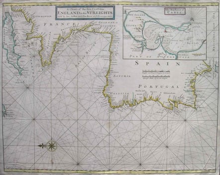
WESTERN SEA COAST OF EUROPE A CHART OF THE SEA COAST FROM ENGLAND TO THE STREIGHTS
Sold
Very attractive Sea Chart of the Sea Coast of Western Europe from the Channel to the Straits of Gibralter.Large inset of the harbour of Cadiz.Compass rose.Rhum lines.Outline colour.Very good condition. SOLD
code : M1929
Cartographer : SELLER John
Date : 1701c London
Size : 45*57cms
availability : Sold
Price : Sold
John Seller (c.1630-1697) was an instrument maker, publisher and mapmaker, now best known as the first Englishman to endeavour to compete with the Dutch in the production and publication of sea-charts.
Seller acquired the printing plates from Jan Jansson’s “Light Der Zee-vaert”, originally engraved in 1620, substituted English titles and then re-published them. For this he was appointed Hydrographer to King Charles II in 1671 - a mark of the king’s concern that domestic chart-making be encouraged and protected, rather than as recognition of work well done.
Seller then embarked on the publication of the English Pilot, a rutter in several volumes, each devoted to a different region of the world, issued from 1671/2 onwards. In 1675, Seller started to issue the “Atlas Maritimus”, a composite sea-atlas of the world, comparable in intent with the work of Dutch publishers such as Jansson and de Wit.
