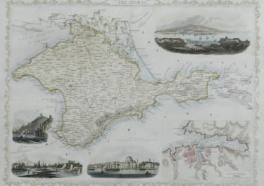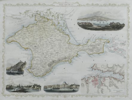
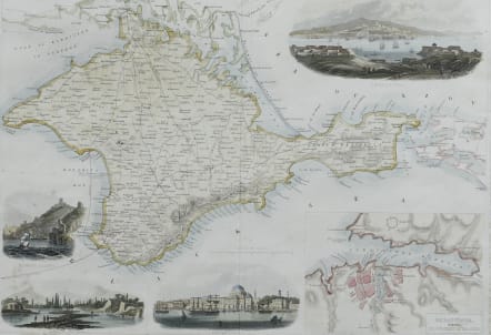
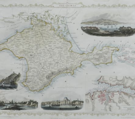
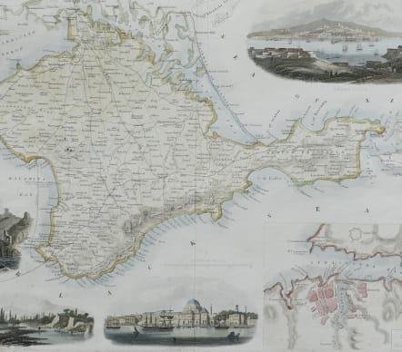
THE CRIMEA
£65
A highly detailed and decorative map of the Crimea with four vignette illustrations.
One of the John Tallis maps published around the time of the Crimea War by The London Printing and Publishing Company.
The map is enhanced by vignette illustrations of Sebastopol, Balaklava Harbour, Eupatoria, and Banks of the Alma,
A detailed inset plan of Sebastopol in the bottom right.
The map drawn and engraved by J Rapkin and the illustrations drawn and engraved by H.Winkles.
Good condition
code : M5500
Cartographer : John
Date : 1858 London
Size : 27*35.5 cms
availability : Available
Price : £65
John Rapkin (1815-1876) drew and engraved the maps for John Tallis’ renowned "Illustrated Atlas" published to coincide with the great exhibition in London in 1851. The maps were also later re-issued by the London Printing and Publishing Company, still bearing the Tallis imprint. Rapkin’s style is elegant and clear and considerable geographical detail and nomenclature is shown on the maps.