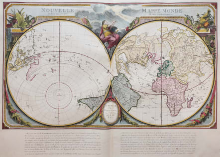
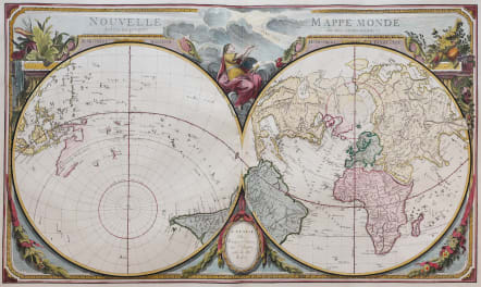
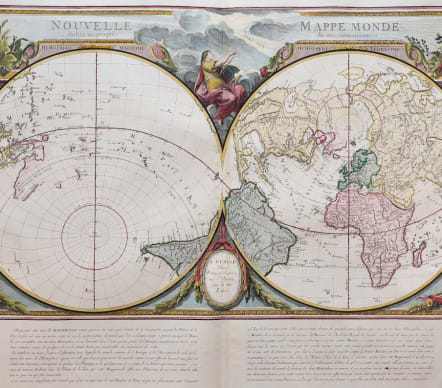
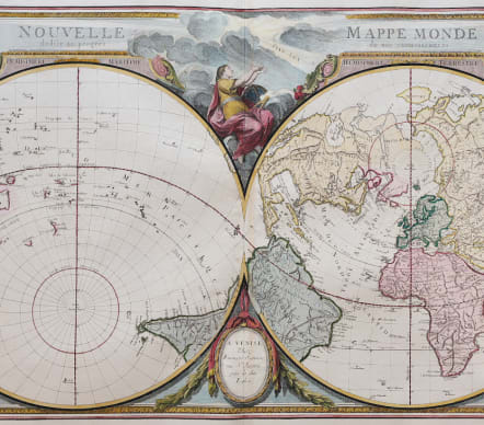
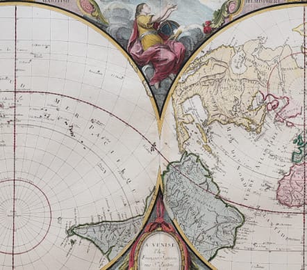
NOUVELLE MAPPE MONDE DEDIEEAU PROGRES DE NOS CONNOISSANCES
£1250
Stunning finely engraved double hemisphere map is surrounded in a rococo style frame in the elaborate French style.
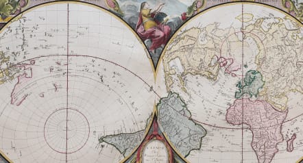
The unusual map is presented on a projection centered on the Tropic of Cancer for the Western Hemisphere and the Tropic of Capricorn in the Eastern Hemisphere.
In North America, the northwest coast includes the conjectural geography of Philippe Buache with the Sea of the West and a Northwest Passage. Within the United States only a handful of cities are identified: Boston, New Orleans, Charleston, New York, Santa Fe, and F. Louis (Mobile, Alabama). In the Eastern Hemisphere, Australia and New Zealand are yet to be completely mapped. Novaya Zemlya has an incomplete coastline and is partially attached to the continent. Terre d' Yesso (Hokkaido) is rendered with a partial coastline as well and is connected to the mainland. Above the hemispheres, a figure holds up outstretched hands to a beam of light inscribed with the words Fiat Lux ("Let there be light"). Below the map are columns of French text.
Excellent hand colour
Mint condition
References: McGuirk #161; Phillips (A) #647-2.
code : M5462
Cartographer : SANTINI Francois
Date : 1776 Venice
Size : 49*68 cms sheet 52*74 cms
availability : Available
Price : £1250
Francois [Francesco] Santini was a Venetian map maker who re-issued the works of Robert de Vaugondy, Homann’s Heirs and De L’Isle. At this time, cartography in Italy was at a rather low ebb, so Santini, essentially a publisher rather than a map-maker modelled his work on two of the leading practitioners of cartography in Europe, the French map-makers Gilles and Didier Robert de Vaugondy. Their “Atlas Universel” was first published in 1758, and was much re-issued thereafter. The atlas was a commercial and cartographic success, with widespread influence on map-makers throughout Europe, most notably on Santini, who commissioned a new set of plates, published in 1776, being almost exact copies of the original French maps.


