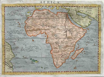
AFRICA
Sold
RARE. The geography and placenames on the map are closely based on Abraham Ortelius' 1570 map of Africa. For example Zanzibar is still on the southwest coast of Africa as on the Ortelius map. The hydrographical systems follow Ortelius precisely with three lakes feeding the Niger River. The sources for the other major rivers on the continent are also the same as on Ortelius' map. This map first appeared in the third edition of D'Anania's La Universale... of 1582, published in Venice. This is the second state of the map and was used in an edition of Ptolemy's Geography in 1598. This map is distinguished by the addition of an engraved line completely encircling Africa. Small repair not noticeable.Cropped a little close but there are margins.Very good hand colour. Good condition. Reference: Betz # 20.2. SOLDcode : M1783
Cartographer : D’Anania.G.L.
Date : 900:/001582 / 1598
Size : 17.5*24.5cms
availability : Sold
Price : Sold
