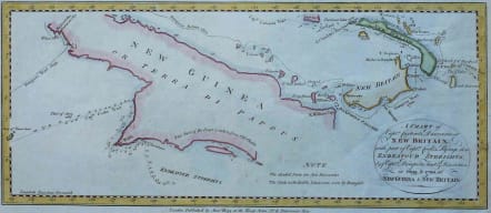
A Chart of Captn. Carteret's Discoveries at New Britain, with part of Captn. Cook's Passage Thro Endeavour Streights, & of Captn. Dampiers Tract & Discoveries in 1699, & 1700, at New Guinea & New Britain
Sold
This sea chart of Papua New Guinea shows the new discoveries of Captains Cook, Carteret, and Dampier along New Guinea, New Britain and New Ireland. The chart details the path of Captain Cooks voyage along the southwestern coast of the island of New Guinea in today's Irian Jaya, Indonesia's easternmost province. Cook sailed between Australia and New Guinea and proved the existence of the Strait of Torres. The chart also details the explorations of Carteret and Dampierre which focused on the northern portion of New Guinea and the nearby Pacific islands.
Good hand colour
Very good condition.
code : M3057
Cartographer : Hogg Alex
Date : 1790 London
Size : 15.5*36.5 cms
availability : Sold
Price : Sold
