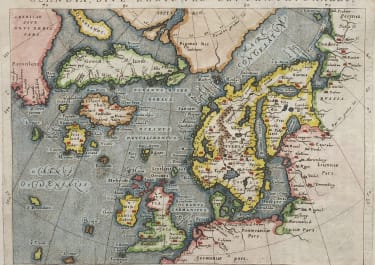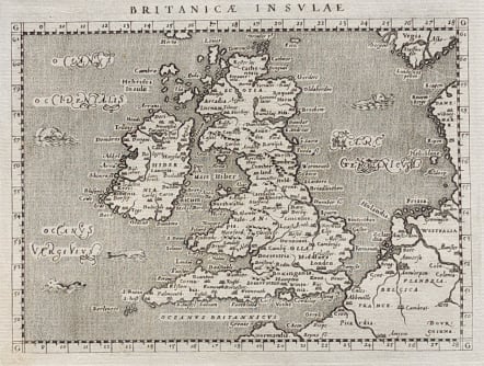
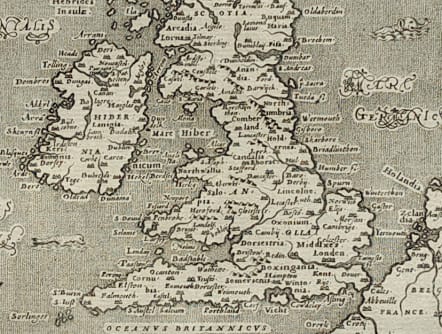
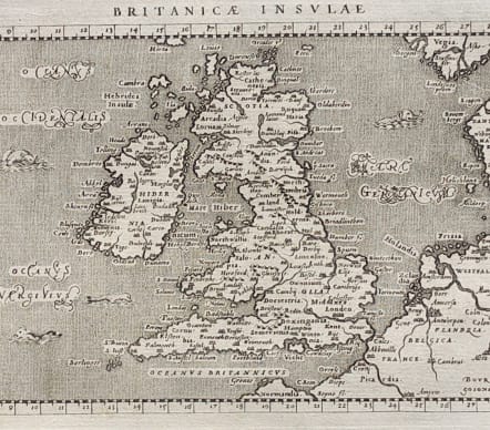
BRITANICAE INSULAE
Sold
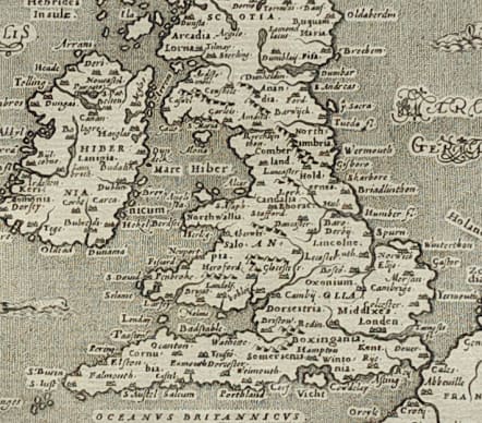
Attractive early map of Britain. The first to show a river bridge at London. It is a charming example of Italian mapmaking with a variety of sea monsters in the stipple engraved sea and fine italic script lettering. Latin text on verso and accompanied by an additional page of text. Uncoloured as issued.
Mint condition
Ref: Moreland & Bannister p. 211; Shirley (MCC-95) #192.
code : M3797
Cartographer : MAGINI Giovanni
Date : 1597 Padua
Size : 13.5*18 cms sheet 30*20 cms
availability : Sold
Price : Sold
Giovanni Antonio Magini (1555-1617) was born in Padua, Italy, and studied medicine, mathematics, astronomy and philosophy at the University of Bologna where he was later to become a professor of astronomy. He corresponded with many of the renowned figures of the age including Ortelius, Tycho Brahe, Galileo and Johanes Kepler. He authored various works on astronomy and also produced the first printed atlas of Italy, which was published posthumously by his son Fabio. Other works included the "Geographiae Universiae" (1597) and "Moderne Tavole Di Geografia" amongst others.