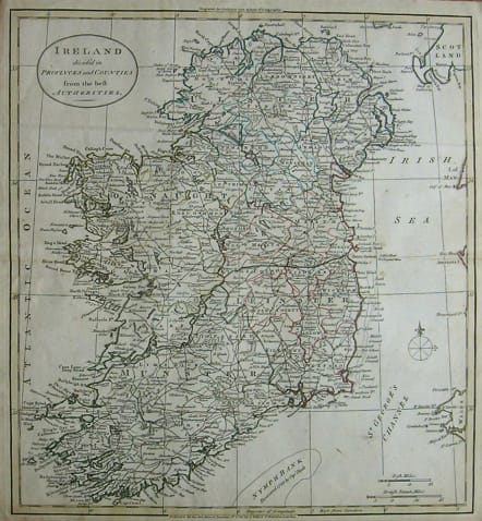
IRELAND DIVIDED INTO PROVINCES AND COUNTIES FROM THE BEST AUTHORITIES
Sold
Attractive map of the whole of Ireland and an early example showing all the roads.Published by Robinson & Dilly and this map was probably engraved by Thomas Kitchen.Original outline colour.
Very good condition.
code : M2414
Cartographer : GUTHRIE William
Date : 1785 London
Size : 37.5*34.5cms
availability : Sold
Price : Sold
Atlas Universel pour la Geographie de Guthrie reengraved by Blondeau
Eastern & Central Europe
Low Countries
Spain & Portugal
Scandinavia
North America
West Indies


