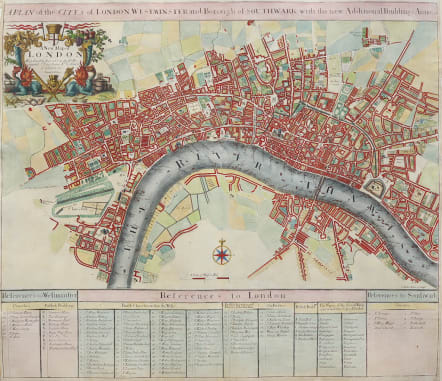
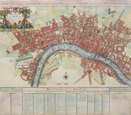
A PLAN OF THE CITY'S OF LONDON, WESTMINSTER AND BOROUGH OF SOUTHWARK WITH THE NEW ADDITIONAL BUILDINGS 1720
Sold
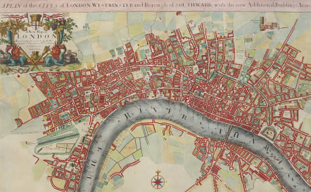
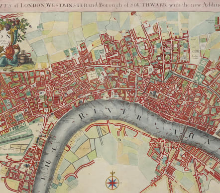
Beautiful folio copper engraved map of early Georgian London. Drawn and engraved by Samuel Parker and revised by John Senex for inclusion in his New General Atlas published in 1721. The map shows in fine detail the rebuilding of London after the great fire from Buckingham House (Palace) in the west to Whitechapel in the east and from Clerkenwell in the north to Lambeth in the south. The bottom portion of the plate comprises several keys that indicate: the churches and public buildings of Westminster; the parish churches, public building and wards of London; and the churches of Southwark. The attractive cartouche includes symbols of London's greatness: two cornucopeias, one of fruit and one of precious metal objects and jewels. At the base is a picture of a king, presumably George I, whose sword and scepter are supported by two dragons. To the sides and behind these are symbols of British cultural and mercantile superiority. The map is dedicated to Sir Peter Delme, a very wealthy and powerful gentleman, one of the first residents of Grosvenor Square, and, for a time, Lord Mayor.
Excellent hand colour.
Very good condition
code : M4930
Cartographer : Senex J
Date : 1721 London
Size : 50.5*59 cms
availability : Sold
Price : Sold

