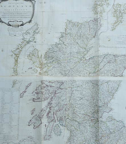
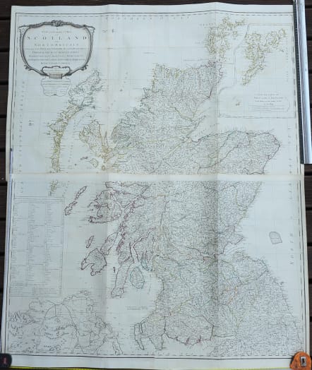
A NEW AND CORRECT MAP OF SCOTLAND OR NORTH BRITAIN
£475
Full Title: A New and Correct Map of Scotland or North Britain with all the Post and Military Roads, Divisions &ca. Drawn from the Most Approved Surveys Illustrated with Many Additional Improvements, and Regulated by the Latest Astronomical Observations by Lieutenant Campbell
Stunning wall map of Scotland from 4 sheets ( here joined to 2 sheets ready to be joined)
The map was prepared by Admiral Surveyor Lieutenant Robert Campbell. Includes an inset of the Shetlands on the same scale and a table of distances on the stage routes.
This map was first issued by Marcus Armstrong in 1782. Robert Sayer's re-issue had extensive re-working of all four plates on the basis of information supplied by Campbell. The Northwest coast is slightly revised and the Western Isles entirely re-drawn except for the North part of Lewis. Some roads are re-drawn and some added. The map includes a new cartouche and title.
Original outline colour
Repair near Lewis, some light offsetting otherwise good for the large map that is often damaged due to size.
REF David Rumsey .. http://www.davidrumsey.com/maps2580.html
code : M4014
Cartographer : LAURIE & WHITTLE
Date : 1794 London
Size : 123*108 cms
availability : Available
Price : £475


