OXONIENSIS
£295
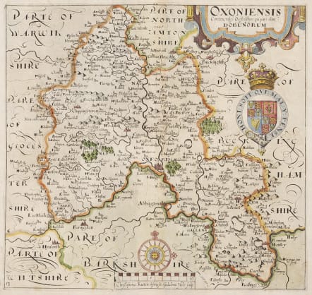
Attractive detailed and decorative early 17th Century map of Oxfordshire which was based on the first survey of the county by Christopher Saxton, engraved by William Hole and published in William Camden's Britannia* (London: 1607-1637).
Elaborately decorated county map includes the arms of James I, a decorative strap work tittle cartouche and fleur-de-lis adorned compass rose above a scale of miles.
Excellent hand colour
Very good condition
code : M4540
Cartographer : Hole William
Date : 1637 London
Size : 27.5*29 cms
availability : Available
Price : £295

British Isles

British Isles