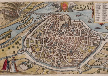
FLORENTIA
Sold
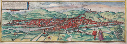
Very attractive and early panorama of Florence from the 1575 French text edition of the Civitates. Excellent hand colour Slight printers crease Very good condition
CARTOUCHE: Florence is a distinguished city in Etruria, formerly called Fluentia, because it lies on the stream of the River Arno. [...] Embellished with beautiful public and private buildings and surrounded by hills on all sides, Florence is the residence of famous men and a most fertile field for outstanding talents.
COMMENTARY BY BRAUN: "For just as Venice is called the rich, Milan the great, Genoa the proud, Bologna the fertile, Ravenna the ancient, Naples the noble and Rome the holy city, so Florence is called the beautiful. It has magnificent churches, of which Santa Maria del Fiore is particularly wonderful: it is built of marble and beside it stands a tower, also of marble, quite magnificently furnished with bells."
The engraving shows Florence from the southwest. On the far side of the Arno, the cathedral of Santa Maria del Fiore with its impressive cupola (1418-1436) by Filippo Brunelleschi soars above the roofs of the densely packed houses. Visible in front of it are the bell tower, built from 1330 to designs by Giotto, and the Baptistery (11th-12th cent.) with its magnificent bronze doors by Andrea Pisano and Lorenzo Ghiberti (1330-1452). Behind it to the right, as a symbol of secular power, is the Palazzo della Signoria (14th cent.), today known as the Palazzo Vecchio, with its 94-m-high tower. Florence was founded as a Roman colony in Caesar's day, when it marked the intersection of two major trade routes. In the 14th and 15th centuries it developed into a city of art and culture, attracting many artists and intellectuals, including Sandro Botticelli, Galileo Gallilei, Leonardo de Vinci and Niccolo Machiavelli. Under the rule of the Medici family, Florence also developed into an important centre of finance and trade. With a population of around 366,000, Florence is today the capital of Tuscany. (Taschen)
References: Van der Krogt 4, 1501, State 2; Taschen, Braun and Hogenberg, p.112
code : M3620
Cartographer : BRAUN & HOGENBERG
Date : 1575 Cologne
Size : 16*48 cms
availability : Sold
Price : Sold
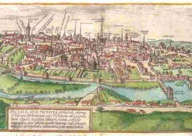
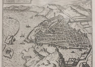
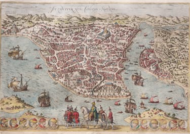
Georg Braun (1541-1622) and Frans Hogenberg (1535-1590) were co-publishers of the monumental Civitates Orbis Terrarum, “the earliest systematic city atlas” (Koeman), published from 1572 onwards. Designed as a companion to Ortelius’ world atlas the Theatrum, this enormous work, which was expanded to six volumes by 1617 incorporating over 500 plans and views, must be viewed as one of the most ambitious book producing ventures of all time, and certainly, with Ortelius’ Theatrum and Blaeu’s Atlas Maior among the greatest achievements in the history of cartography.
Braun compiled the accompanying text, printed on the reverse of the engraved sheets, while the plans were engraved by Hogenberg, who had also prepared some of the maps for Ortelius’ Theatrum. Hogenberg used generally up-to-date and accurate maps, surveys and reports from local sources to compile this collection of plans and bird’s-eye views of all the major towns of Europe, some African, Middle Eastern and Indian towns, and the New World cities of Mexico and Cusco. One of the major contributors was Georg (or Joris) Hoefnagel, who supplied some 63 manuscript drawings, the vast majority from personal observation.