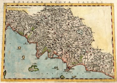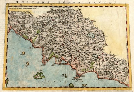
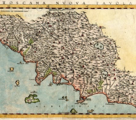
TOSCANA NUOVA TAVOLA
£375
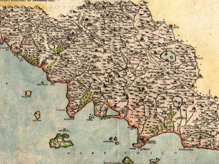
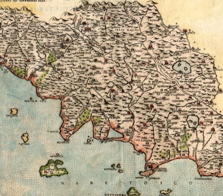
Attractive and detailed Ruscelli map. From his work La Geografia di Claudio Tolomeo Alessandrino. Based on the work of Ptolemy, it depicts the entire region of Tuscany as it was divided in the 16th century.
The map is highly detailed, depicting settlements, town and cities of the region. Cities, fortifications, churches and cathedrals all have their own symbols on the map. Additionally, river systems, ports and mountain ranges are denoted and numerous islands off the west coast of Tuscany are depicted.
Although this is second issue; The only difference between first state of 1561 and this is that the first state 2 maps printed on same sheet and cut leaving n,o ^plate mark at top.
Good hand colour
Very good condition
Ruscelli's maps are based on a set of smaller maps published by Giacomo Gastaldi in 1548, which included a number of modern maps, many of which are the earliest obtainable regional maps of the areas depicted.
code : M5459
Cartographer : RUSCELLI Girolamo
Date : 1561 / 1574
Size : 18.5*26 cms sheet 23*31 cms
availability : Available
Price : £375
Girolamo Ruscelli (1500s-1566) was an Italian polymath, humanist, editor, and cartographer active in Venice during the early 16th century. Ruscelli is best known for his important revision of Ptolemy's Geographia, which was published post humously in 1574. It is generally assumed that Alexius Pedemontanus was a pseudonym of Girolamo Ruscelli. In a later work, Ruscelli reported that the Secreti contained the experimental results of an ‘Academy of Secrets’ that he and a group of humanists and noblemen founded in Naples in the 1540s. Ruscelli’s academy is the first recorded example of an experimental scientific society. The academy was later imitated by Giambattista Della Porta, who founded an ‘Accademia dei Secreti’ in Naples in the 1560s.