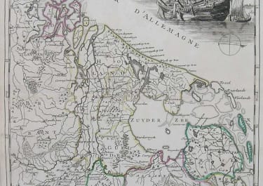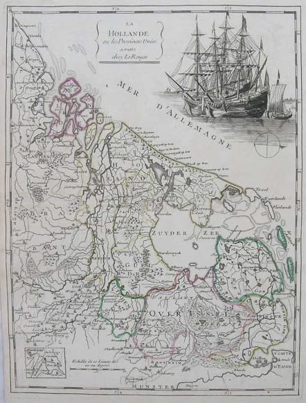
HOLLAND LA HOLLANDE OU LES PROVINCES UNIES
£85
An attractive map of the Netherlands with a small inset of the vicinity of Maestricht. The map is decorated with a fine engraving of ships at anchor in the sea, representing Dutch trade dominance.
Original outline colour.
Very good condition.
code : M2613
Cartographer : ROUGE LE Georges-Louis
Date : 1748 Paris
Size : 28*22 cms
availability : Available
Price : £85
Lieutenant George-Louis Le ROUGE
Lieutenant George-Louis Le Rouge (c.1712-c.1790) was born in Hanover, Germany. He became a Lieutenant in the regiment of Saxe before establishing himself as a publisher, compiler and editor of maps in Paris. He later became the “Ingenieur Geographe de Roi”.
Le Rouge is particularly known for such atlas works as the “Atlas Nouveau” of 1746 and the “Atlas Nouveau Portatif ...” or the “Introduction A La Geographie” of 1756 – French publications of some merit.
Le Rouge was initially a military “Ingenieur” for fortifications and he was also a map-maker for the army and Marine Royale. He was active between 1740 and 1780, in Paris at, rue des Augustins.