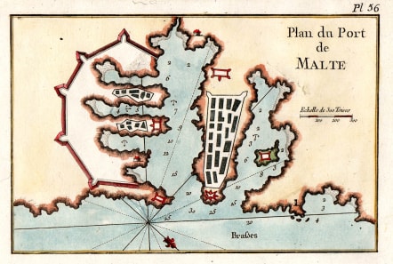
PLAN DU PORT DE MALTE
£60
Good little chart Chart of Valetta Malta , published in 'Recueil des principaux plans des ports et rades de la mer Méditerranée' by Joseph Roux le jeune (1725-93). This portable atlas of plans of ports of the Mediterranean was designed as a companion piece to his important 12-sheet atlas of the Mediterranean, a copy of which Nelson had aboard the 'Victory'.
Slight blemish
Very good colour
V. Good condition
code : M5243
Cartographer : ROUX Joseph
Date : 1750c Marseille
Size : 13*19.5 cms
availability : Available
Price : £60
Joseph Roux.Marseilles.Published many sea charts and portolans.
Spain & Portugal
Mediterranean & Islands


