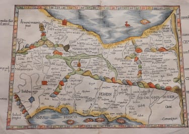
ARABIA TABULA VI ASIAE
£1000
Stuuning map of Arabia
This beautiful woodblock map is an early Ptolemaic map of the Arabian Peninsula here called Arabia Felix. It is a fairly good representation of the peninsula, although Ptolemy overestimated the width of the southern part of the peninsula and distorted the shape of the Arabian Gulf. The map is presented on a trapezoidal projection with parallels and meridians (forerunners of lines of longitude and latitude) enumerated in the borders. The title appears on verso along with Latin text and woodblock illustrations. Laurent Fries produced the woodblocks for this edition of Ptolemy's Geography in a reduced version of the Waldseemuller maps from the 1513 edition.
Minor reinforcement on rear of centre fold invisible . repaired wormhole outside printed sueface not affecting map.
Good hand colour
Very good condition
References: Mickwitz & Miekkavaara #209-39; Al Ankary #7.
Publication Claudii Ptolemaei Alexandrini Geographicae
code : M5241
Cartographer : FRIES Lorenz
Date : 1535
Size : 27.5*45 cms sheet 37.5*51 cms
availability : Available
Price : £1000
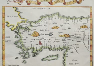
Laurent Fries (*1485 - †1532)
Laurent Fries was a French physician and mathematician born around 1485 in Mulhouse. He settled finally in Strassburg where he meat Peter Apian and the publisher Johannes Grüninger which made him interested in the Ptolemy Atlas of 1513 and 1520. Fries made new woodcut maps in reduced size. His Ptolemy Atlas was published first in 1522, reissued in 1525, 1535 and 1541. He died in 1532.