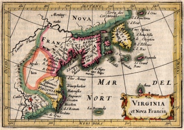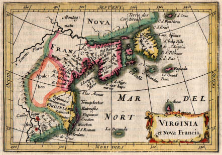
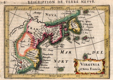
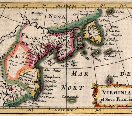
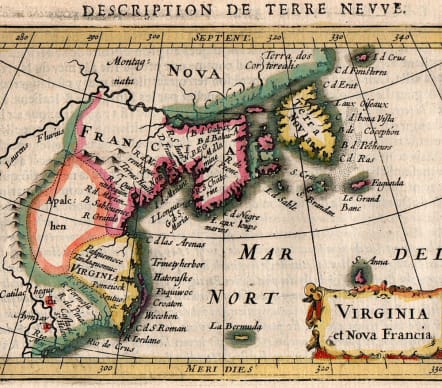
VIRGINIA ET NOVA FRANCA
£550
Fine early map of the East Coast of North America, first published by Bertius and Jodocus Hondius Jr. in 1616.
Very beautiful early map by Petrus Bertius of the East Coast of North America, first published by Bertius and Jodocus Hondius Jr. in 1616.
The map extends from Cape May, Florida, in the South to Labrador, deriving from the Jodocus Hondius World Map of 1611.
One of the earliest obtainable maps of the East Coast of North America.
The map over-emphasizes the coastal regions of Virginia and Nova Scotia, thereby distorting the remaining geographical details.
Original hand coloring (this was only done to a very limited number of these atlases).
Very good condition
Published by Hondius in Amsterdam in 1618 in a French edition of ´Géographie raccourcie par Pierre BERTIUS
Burden, P.D. 185; Cumming, W.P. (SE) 31.
code : M5571
Cartographer : Petrus BERTIUS
Date : 1616 Amsterdam
Size : 9.5*13,5 cms , sheet 12,5*19 cms
availability : Available
Price : £550
Petrus BERTIUS
The origins of the miniature pocket atlas lie in Barent Langenes Caert Thresoor of 1598. A large number of the 169 maps were engraved by Petrus Kaerius (Van Den Keere). This small but attractive atlas was sold for the first time in 1599 by Cornelis Claesz in Amsterdam. In 1600, Claesz published the atlas with a Latin text composed by Petrus Bertius; from then on, new editions, often enlarged with new maps, regularly appeared. Petrus Bertius was born at Beveren, Flanders, in November 1565. As a refugee, Bertius settled in Amsterdam and, after finishing his studies, he became a professor of mathematics and librarian at the University of Leiden. In 1618 he also became cosmographer and historiographer to Louis XIII of France, and lived in Paris, where he died in October 1629. His fame among geographers was established by his text in the pocket atlas Tabularum Geographicarum.