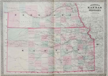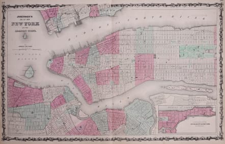
JOHNSON'S MAP OF NEW YORK
Sold
Detailed large map of Manhattan and parts of Brooklyn, Jersey City and Hoboken, set within an elaborate Victorian foliate border. Manhattan is shown from Battery Park to 88th Street. Governors Island, Ellis Island, the U.S. Cob Dock and Blackwell Island (later renamed Roosevelt Island) are also shown. An inset map in the lower right titled "Continuation of the City & County of New York on a Reduced Scale" shows the rest of Manhattan from 86th Street north. The map of Brooklyn includes the downtown area surrounding the Navy Yard, as far south as Red Hook and as far north as Williamsburg and Greenpoint. A small portion of the relatively undeveloped Queens shoreline is also shown. The map shows parks, squares, streets, boat slips and railroads. Wards are numbered and colored in shades of light and dark pink, yellow and green. Footprints of some major buildings are also indicated, and institutional buildings on Blackwell's Island are labeled, as are the major features of Central Park. Although the Crystal Palace in midtown Manhattan had burned down in 1858, it is still shown on the map. This is the horizontal version of the Johnson atlas New York City map. A revised version, in a vertical format, was first published in 1865.
Near mint condition
code : M3215
Cartographer : Johnson A
Date : 1865
Size : 41*66 cms
availability : Sold
Price : Sold
American publisher of Atlases