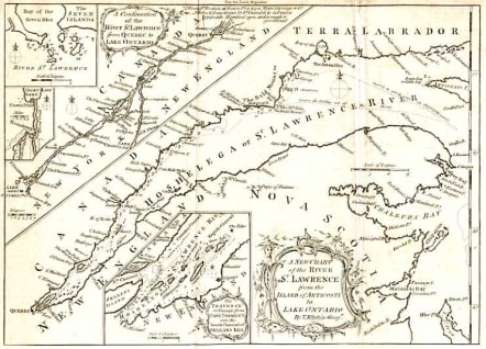
A NEW CHART OF THE St LAWRENCE
Sold
Detailed map of the St Lawrence to Quebec with inset maps covering Montreal.Rococo cartouche.Good condition.
code : M760
Cartographer : KITCHIN Thomas
Date : 1770c London
Size : 18.5*26cms
availability : Sold
Price : Sold
Thomas Kitchin (1718-1784) was one of the best and most prolific engravers of the eighteenth century. He issued The General Atlas, Describing the Whole Universe , first published in 1773, and regularly reissued thereafter. His work also included a large number of maps of the English counties, particularly for the London Magazine (1747-1760), the Universal Magazine (1747-1766), and for Dodsley’s England Illustrated (1764). Other maps were published in conjunction with Emanuel Bowen in the Large English Atlas and the Royal English Atlas (1763).