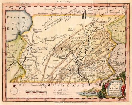
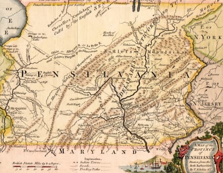
A MAP OF THE PROVINCE OF PENSILVANIA DRAWN FROM THE BEST AUTHORITIES BY T KITCHEN
£475
Important map
The First Map of The Complete Province of Pennsylvania
This map appeared in the December issue of London Magazine 1756. It is based upon the 1749 Evans map and incorporates the 1732 boundary agreement between Lord Baltimore and the Penns, which set the boundary at essentially its present position. The boundary with New York is placed at about 42d 30m and called undefined. The western boundary is a mirror image of the eastern and is placed just west of "F. du Quesne." Kitchin apparently read accounts of western Pennsylvania as Ohiopyle Falls on the Youghiogheney River are identified. This is the first map of all the state of Pennsylvania itself, rather than the Philadelphia or Mid-Atlantic regions. It pre-dates the larger and better known 1759 Scull map of Pennsylvania by three years. Phillips page 673. Longitude from Philadelphia at top, London at bottom. Blank verso.
Excellent hand colour
Very good condition
Ref https://www.mapsofpa.com/18thcentury/1756kitchin.jpg
code : M5406
Cartographer : KITCHIN Thomas
Date : 1756 London
Size : 17*22 cms sheet size 20.5*24.5 cms
availability : Available
Price : £475
Thomas Kitchin (1718-1784) was one of the best and most prolific engravers of the eighteenth century. He issued The General Atlas, Describing the Whole Universe , first published in 1773, and regularly reissued thereafter. His work also included a large number of maps of the English counties, particularly for the London Magazine (1747-1760), the Universal Magazine (1747-1766), and for Dodsley’s England Illustrated (1764). Other maps were published in conjunction with Emanuel Bowen in the Large English Atlas and the Royal English Atlas (1763).

