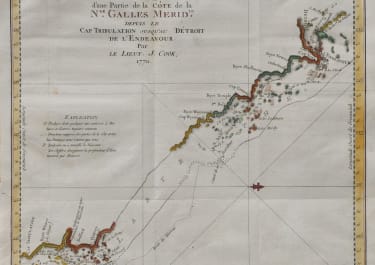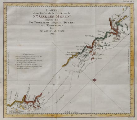
CARTE D'UNE PARTIE DE LA COTE DE LA NLLE GALLES MERIDLE
£200
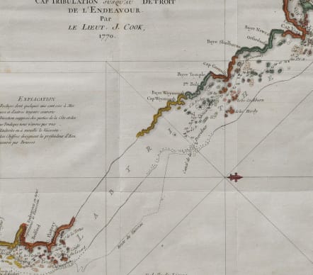
First French edition of the first chart to detail the Great Barrier Reef, discovered by the legendary navigator James Cook during his first voyage aboard the H.M.S. Endeavor . the first French edition of the first chart to detail the Great Barrier Reef, discovered by the legendary navigator James Cook during his first voyage aboard the H.M.S. Endeavor . This west-oriented chart captures the great explorer's difficult journey along the coast of Australia from Cape Tribulation to Cape York, during which he became the first European to navigate - with difficulty, and under duress - the Great Barrier Reef, which he tellingly named 'The Labyrinth.' Cape Tribulation The southernmost extent of this chart is 'Cap Tribulation,' so called by Cook because 'here begun all our troubles.'
Good hand colour
Very good condition
code : M5547
Cartographer : Benard
Date : 1774
Size : 29.5*33.5 cms
availability : Available
Price : £200