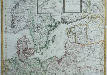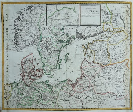
A NEW MAP OF THE BALTICK
£450
Full Title: A new map of the Baltick &c : shewing all the dominions about it with ye great or post roads and principal cross-roads
This rare and attractive map of northern Europe is filled with details of towns, rivers, roads, and the topography of the land.
Political boundaries are shown and postal routes are noted. An inset at top depicts the entrance to the Baltic Sea between Denmark and Sweden. Decorated by a compass rose with fleur-de-lis and simple block-style title cartouche.
Original colour.
Very good condition
Ref https://collections.leventhalmap.org/search/commonwealth:cj82kt05v
code : M3256
Cartographer : MOLL Herman
Date : 1720 London
Size : 52*62 cms
availability : Available
Price : £450
Herman Moll (1654? - 1732) was an important 18th century map publisher and engraver based in London and Holland
He moved to London in 1680 where he worked as an engraver for Moses Pitt, among other London map publishers. Around the turn of the century, Moll set up his own shop where he produced a large corpus of work known for its high quality and decorative flair.