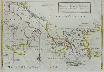
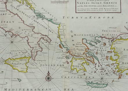
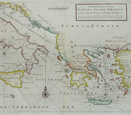
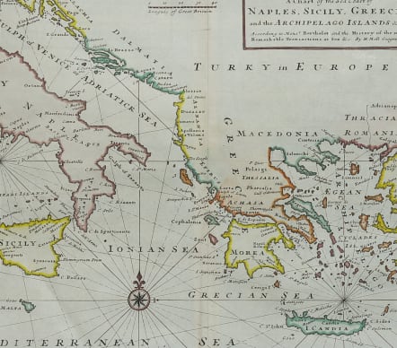
A CHART OF THE SEA COAST OF NAPLES SICILY GREECE AND THE ARCHIPELAGO ISLANDS
£295
Scarce sea chart by Moll of the Eastern Mediterranean with compass rose and rhumb lines .
Covers the area from Venice and Sicily tp Crete and Constantinople.
Typical Moll map and type. Margin extended for framing with no loss to map .
Excellent hand colour
Very good condition for this scarce map.
code : M4848
Cartographer : MOLL Herman
Date : 1740c London
Size : 30*42.5 cms
availability : Available
Price : £295
Herman Moll (1654? - 1732) was an important 18th century map publisher and engraver based in London and Holland
He moved to London in 1680 where he worked as an engraver for Moses Pitt, among other London map publishers. Around the turn of the century, Moll set up his own shop where he produced a large corpus of work known for its high quality and decorative flair.