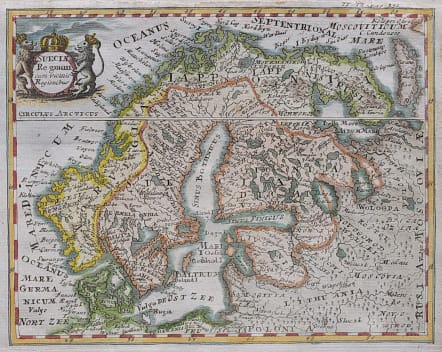
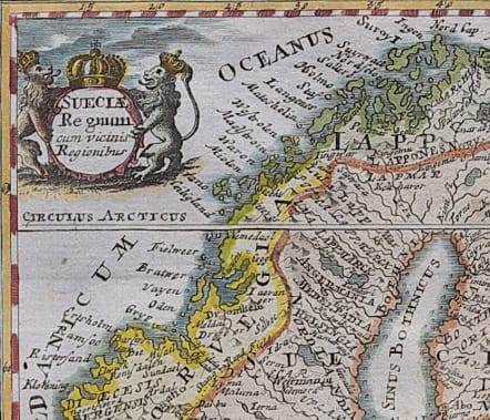
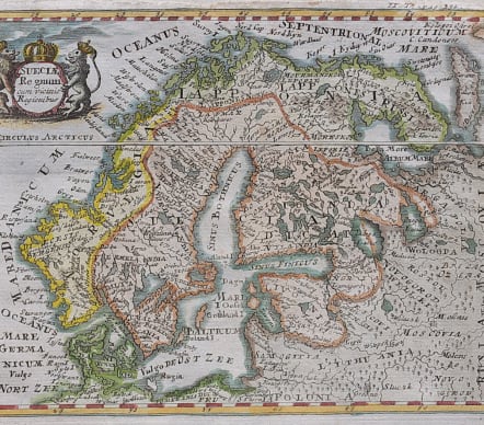
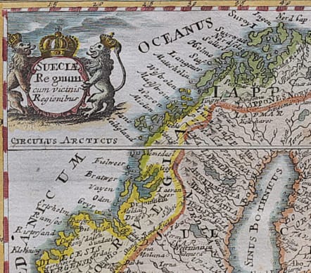
SUECIAE REGNUM CUM VICINIS REGIONIBUS
Sold
Rare and attractive small map of Scandinavia by Weigel in 1717 but here issued in a travel book by De Launay. Misshapen coastlines.
Decorative cartouche with a crown and two crowned lions.
Good hand colour. Very good condition
code : M3553
Cartographer : WEIGEL Christoph
Date : 1738
Size : 14.5*18.5 cms
availability : Sold
Price : Sold
Christoph Weigel (c.1654-1725) and his relation Johann Weigel worked out of Nuremberg in the first half of the eighteenth century. Weigel is also known for a number of maps featuring in Faber’s “Atlas Scholasticus” (1718) and also the “Schul- Und Reisen Atlas”, produced in conjunction with JD Köhler.
Weigel was also involved with Köhler’s “Descriptio Orbis Antiqui” published c.1720. This volume contained in total forty four well engraved maps of the ancient world, many decorated with vignettes illustrating coins, medallions and mythological scenes.