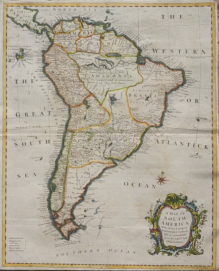
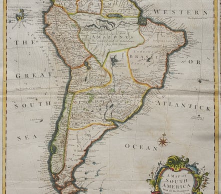
A MAP OF SOUTH AMERICA WITH ALL THE EUROPEAN SETTLEMENTS
£245
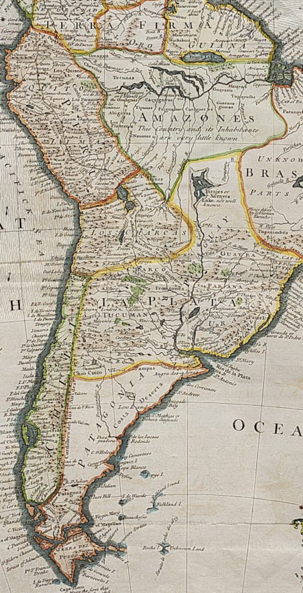
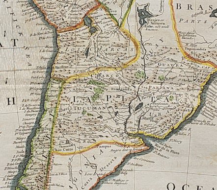
Handsome map filled with names of European and Indian cities, forts, castles and gold and silver mines. The spurious Prime Lake sits near Guiana with the fanciful city of Manoa, o el Dorado located on its banks. The Amazon Basin is described by This Country and its Inhabitants are very little known, a note that is also applied to the fictional Iarajes or Xarayes Lake that forms the headwaters of the La Plata. The map is decorated with a lovely rococo cartouche and a compass rose.
Excellent hand colour
Very good condition.
code : M3794
Cartographer : Seale, Richard
Date : 1740c London
Size : 47*38 cms
availability : Available
Price : £245
Richard William Seale (d.1785, fl.1732-1772) was a well-known engraver and draughtsman working in London. His work is often encountered in the maps from Tindal’s continuation of "Rapin's History Of England" (1744-1777). The atlas primarily contains maps depicting the military actions fought by the English during the campaigns of the War of the Spanish Succession, notably in the Low Countries, but also in Spain, and was also supplemented by a series of contemporary maps, of the countries of the British Isles, and parts of the wider world. Seale also contributed to a large number of other books, magazines and atlases of the period – the “London Magazine” and the “Universal Magazine”.