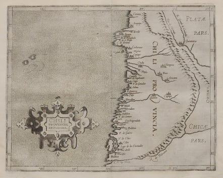
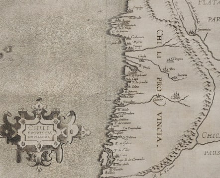
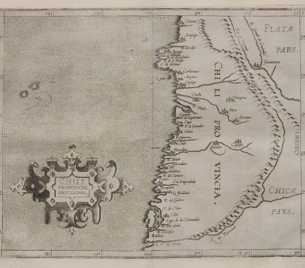
CHILI PROVINCIA AMPLISSIMA
£595
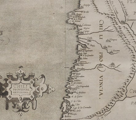
Scarce and attractive map Chile one of the first seperately printed maps.
.Shows cities, towns, landmarks, rivers, capes, bays and mountains. Relief shown pictorially. Includes decorative title cartouche.
Small repaired wormhole
Very good condition
References: Van der Krogt 3, 9920:371 Variant b.
From: Histoire Universelle des Indes Occidentales. Douai, Françoes Fabri, 1607. (Van der Krogt 3, 371:12)
code : M5066
Cartographer : Cornelius Wytfliet
Date : 1597 / 1607
Size : 23*29.5 cms
availability : Available
Price : £595
Cornelius Wytfliet was a geographer from Leuven. After graduating Licentiate in Laws from the University of Leuven, Wytfliet moved to Brussels and became secretary to the Council of Brabant.
In 1597 he published the first atlas of America: the Descriptionis Ptolemaicae Augmentum (Augmentation to Ptolemy’s description). He named his work an augmentation to Ptolemy’s Geography because it covers the Americas, a part of the world unknown to Ptolemy. However, there is no other connection between the works of Ptolemy and Van Wytfliet
Dedicated to Philip III of Spain it is a history of the New World to date, recording its discovery, natural history, etc. It provides a history of exploration and the voyages of Christopher Columbus (1492-1502), John Cabot (1497-98), Sebastian Cabot (1526-28), Francisco Pizarro (1527-35), Giovanni de Verazzano (1524), Jacques Cartier (1540-42), and Martin Frobisher (1576-78). Most of Van Wytfliet’s maps are the first or among the earliest of specific regions of North and South America.