AMERICA DESCRITTIONE DELL'AMERICA
Sold
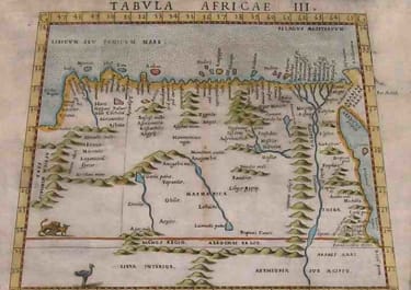
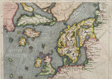
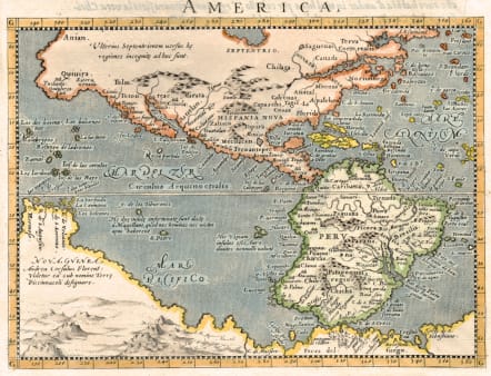
Attractive and finely engraved map is derived from Giovanni Lorenzo d'Anania's 1582 map of the Americas and further based on the geography of Ortelius. Most notable is the characteristic bulge to the west coast of South America and the huge Southern Continent that attaches to Nova Guinea. Anian and Quivira appear on North America's bulbous western coast. Girolamo Porro engraved the map in 1596 for Magini's edition of Ptolemy's Geographia.
Set in a page of text
Mint condition
Publication: Geographiae Universae
Ref: Burden #93.
code : M4553
Cartographer : MAGINI Giovanni
Date : 1596 Venice
Size : 13.5*18 cms map 30*20 sheet
availability : Sold
Price : Sold
Giovanni Antonio Magini (1555-1617) was born in Padua, Italy, and studied medicine, mathematics, astronomy and philosophy at the University of Bologna where he was later to become a professor of astronomy. He corresponded with many of the renowned figures of the age including Ortelius, Tycho Brahe, Galileo and Johanes Kepler. He authored various works on astronomy and also produced the first printed atlas of Italy, which was published posthumously by his son Fabio. Other works included the "Geographiae Universiae" (1597) and "Moderne Tavole Di Geografia" amongst others.